

Garmin BlueChart G3 Vision VEU723L Southern Europe
R9,899
Derived from official charts and private sources to provide navigational aids, spot soundings, depth contours, tides and currents, and detailed harbors and marinas.
In stock
Fast delivery directly to your door!
- Satisfaction Guaranteed
- After Sales Service
- Secure Payments
Garmin BlueChart G3 Vision VEU723L Southern Europe
The Garmin BlueChart G3 Vision VEU723L Southern Europe offers detailed coverage of the Atlantic and Mediterranean coast of Western Europe, the British Isles and northwestern Africa.
Coverage includes the Azores, Canary, Balearic, Channel, and Shetland Islands; Sardinia, Corsica and Madeira, the western Mediterranean Sea from La Spezia, IT to the Strait of Gibraltar, Bay of Biscay, English Channel, Irish Sea, Waddenzee, IJsselmeer, the inland canals and waterways of France and Benelux; the Garonne, Loire, Seine and Rhone River systems; the Rhine River to Neuwied, DE; Lake Leman (Geneva), the entire British Isles including Lough Neagh, the Caledonian Canal, the Isles of Wight and Man and the Thames River and Estuary; the coast of Africa from Cape Bojador, EH to Cape Bougaroun, DZ.
FEATURES
- Derived from official charts and private sources to provide navigational aids, spot soundings, depth contours, tides and currents, and detailed harbors and marinas
- Garmin Auto Guidance technology shows a suggested route to a destination
- Depth Range Shading for up to 10 depth ranges enables you to view your target depth at a glance
- Up to 1-foot contours provide a more accurate depiction of the bottom structure for improved fishing charts and navigation
- Shallow Water Shading feature allows for depth shading at a user-defined level to aid in navigation
- Unique 3D views like MarinerEye and FishEye provide additional perspective both above and below the water line
- High-resolution satellite imagery of ports, marinas, bridges and navigational landmarks for superior situational awareness
- Worldwide coverage available
- Keep your charts up to date with our industry-leading New Chart Guarantee and discount card update program
- Auto Guidance – Auto Guidance technology quickly calculates a suggested route using your boat’s dimensions and a suggested path to follow.
- High Resolution Relief Shading – This exceptional shading feature combines color and shadow to give you an easy-to-interpret view of bottom profile, making it easy to find artificial reefs, underwater shelves and more. High-resolution relief shading is available as a free downloadable feature via the
- ActiveCaptain® app.
- Depth Range Shading – Displays high-resolution Depth Range Shading for up to 10 depth ranges so you can view your designated target depth.
- Detailed Contours – BlueChart g2 Vision HD features 1-foot contours that provide a more accurate depiction of bottom structure for improved fishing charts and enhanced detail in swamps, canals and port plans.
- MarinerRye View – Provides a 3-D representation of the ocean floor as seen from below the waterline.
- FishEye View – Provides a 3-D representation of the surrounding area both above and below the waterline.
- High-resolution Satellite Imagery – High-resolution satellite imagery with navigational charts overlaid gives you a realistic view of your surroundings so you can navigate with a clear moving-chart representation of your boat’s position. It’s our most realistic charting display in a chartplotter.
- Aerial Photography – Crystal clear aerial photography shows exceptional detail of many ports, harbors and marinas and is ideal when entering unfamiliar ports.
SPECIFICATIONS
- File Information: The file size of this download and space required on your microSD™/SD™ card is 2.27 GB. It is not recommended that this download be loaded directly to your device. It only can be loaded to a prepared or blank microSD/SD card (recycled microSD cards may be used to program map data). Up to 500 MB of additional space may be required for software updates.
COMPATIBLE DEVICES
- D2™ Delta
- D2™ Delta PX
- D2™ Delta S
- D2™ Mach 1
- Descent™ Mk2
- Descent™ Mk2i
- Descent™ Mk2S
- echoMAP™ 42dv
- echoMAP™ 50dv
- echoMAP™ 52dv
- echoMAP™ 70dv
- echoMAP™ 71sv
- echoMAP™ 72sv
- echoMAP™ 91sv
- echoMAP™ 92sv
- echoMAP™ CHIRP 42cv
- echoMAP™ CHIRP 92sv
- ECHOMAP Plus 42cv
- ECHOMAP Plus 62cv
- ECHOMAP Plus 72cv
- ECHOMAP Plus 72sv
- ECHOMAP Plus 92sv
- ECHOMAP UHD 62cv
- ECHOMAP™ UHD 72cv
- ECHOMAP™ UHD 72sv
- ECHOMAP™ UHD 92sv
- ECHOMAP™ UHD2 5″ Chartplotters 52cv Without Transducer
- ECHOMAP™ UHD2 7″ Chartplotter
- ECHOMAP™ Ultra 102sv with GT56UHD-TM Transducer
- ECHOMAP™ Ultra 102sv without Transducer
- ECHOMAP™ Ultra 122sv with GT56UHD-TM Transducer
- ECHOMAP™ Ultra 122sv without Transducer
- Enduro™ 2
- epix™ (Gen 2)
- fēnix 6 – Pro Solar Edition
- fēnix® 6 Pro and Sapphire
- fēnix® 6S Pro and Sapphire
- fēnix® 6S Pro Solar
- fēnix 6X – Pro and Sapphire editions
- fenix® 6X – Pro Solar Edition
- fēnix® 7 – Sapphire Solar Edition
- fēnix® 7 – Solar Edition
- fēnix® 7 – Standard Edition
- fēnix® 7S – Sapphire Solar Edition
- fēnix® 7S – Solar Edition
- fēnix® 7S – Standard Edition
- fēnix® 7X – Sapphire Solar Edition
- fēnix® 7X – Solar Edition
- Forerunner® 945
- Forerunner® 955
- Forerunner® 955 Solar
- GPSMAP® 1020
- GPSMAP® 1020xs
- GPSMAP® 1022
- GPSMAP® 1022xsv
- GPSMAP® 1222
- GPSMAP® 1222 Plus
- GPSMAP® 1222xsv
- GPSMAP® 1222xsv Plus
- GPSMAP® 1223, Non-sonar with Worldwide Basemap
- GPSMAP® 1223xsv, SideVü, ClearVü and Traditional CHIRP Sonar with Worldwide Basemap
- GPSMAP® 421s
- GPSMAP® 521
- GPSMAP® 521s
- GPSMAP® 620
- GPSMAP® 62s
- GPSMAP® 64
- GPSMAP® 64s
- GPSMAP 64sx
- GPSMAP 64x
- GPSMAP® 65
- GPSMAP® 65s
- GPSMAP® 66i
- GPSMAP® 66s
- GPSMAP® 66sr
- GPSMAP® 720
- GPSMAP® 720s
- GPSMAP® 722 Plus
- GPSMAP® 722xs Plus
- GPSMAP® 723, Non-sonar with Worldwide Basemap
- GPSMAP® 723xsv, SideVü, ClearVü and Traditional CHIRP Sonar with Worldwide Basemap
- GPSMAP® 7407xsv
- GPSMAP® 7408xsv
- GPSMAP® 7410xsv J1939
- GPSMAP® 7412xsv
- GPSMAP® 7416xsv
- GPSMAP® 8410
- GPSMAP® 8410xsv
- GPSMAP® 8412
- GPSMAP® 8412xsv
- GPSMAP® 8416
- GPSMAP® 8416xsv
- GPSMAP® 8417 MFD
- GPSMAP® 8422 MFD
- GPSMAP® 8424 MFD
- GPSMAP® 8700 Black Box
- GPSMAP® 922 Plus
- GPSMAP® 922xs Plus
- GPSMAP® 923, Non-sonar with Worldwide Basemap
- GPSMAP® 923xsv, SideVü, ClearVü and Traditional CHIRP Sonar with Worldwide Basemap
- MARQ® Adventurer
- MARQ® Athlete
- MARQ® Aviator
- MARQ® Aviator Performance Edition
- MARQ® Captain
- MARQ® Captain: American Magic
- MARQ® Commander
- MARQ® Driver
- MARQ® Driver Performance Edition
- MARQ® Golfer
- Montana® 700
- Montana® 700i
- Montana® 750i
- Oregon® 700
- Oregon® 750
- Panoptix™ Ice Fishing Bundle
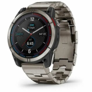
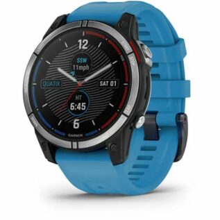
- quatix® 6
- quatix® 6 Titanium
- quatix® 6X Solar
- quatix® 7
- quatix® 7 – Sapphire Edition
- quatix® 7X – Solar Edition
- tactix® 7 – Pro Ballistics Edition
- tactix® 7 – Pro Edition
- tactix® 7 – Standard Edition
- tactix® Delta – Sapphire Edition
- tactix® Delta – Solar Edition
| Brand |
|---|
Only logged in customers who have purchased this product may leave a review.


Reviews
There are no reviews yet.